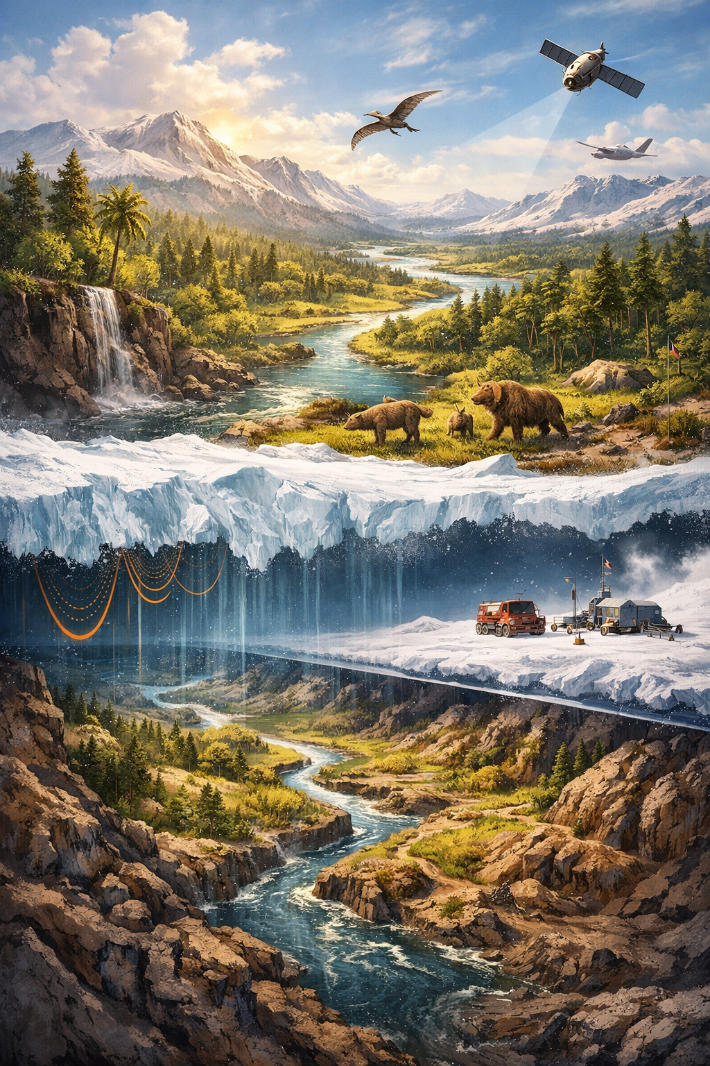
For decades, Antarctica has been perceived as a frozen, lifeless continent—an immense expanse of ice shaped by extreme cold and relentless winds. Yet recent scientific discoveries are dramatically reshaping this image. Beneath more than two kilometers of ice in East Antarctica, researchers have uncovered a remarkably well-preserved ancient landscape: a vast network of river valleys, hills, and forested terrain that dates back approximately 34 million years.
This hidden world offers extraordinary insight into Earth’s climatic past and provides vital clues about how the Antarctic ice sheet formed, evolved, and may respond to modern climate change.
A Lost Landscape Beneath the Ice
Using advanced ice-penetrating radar, satellite imagery, and geophysical modeling, an international research team led by scientists from Durham University mapped an ancient terrain buried deep below the East Antarctic Ice Sheet. The newly identified landscape covers an area roughly the size of Belgium, making it one of the largest intact subglacial landscapes ever discovered.
What makes this finding exceptional is the clarity of the landforms. The radar images reveal branching river systems, broad valleys, ridgelines, and elevated plateaus—features that are unmistakably shaped by flowing water rather than by glaciers. These patterns indicate long-term erosion by rivers, suggesting that the region once experienced sustained rainfall and surface runoff.
Unlike many other subglacial regions that have been heavily altered by moving ice, this landscape appears almost frozen in time.
Antarctica Before the Ice Age
The newly uncovered terrain dates back to the transition between the Eocene and Oligocene epochs, around 34 million years ago—a pivotal moment in Earth’s climatic history. During the late Eocene, global temperatures were significantly warmer than today, and atmospheric carbon dioxide levels were much higher.
At that time, Antarctica was not the icy desert we know today. Instead, it supported lush forests, flowing rivers, and diverse plant life. Previous fossil discoveries, including pollen from temperate and even subtropical plants such as palms, suggest that parts of Antarctica once resembled modern-day southern South America or New Zealand.
The dramatic global cooling that followed marked the birth of Antarctica’s permanent ice sheets. As temperatures dropped and CO₂ levels declined, glaciers expanded rapidly, eventually entombing the ancient landscape beneath kilometers of ice.
Why the Landscape Survived Intact
One of the most intriguing aspects of this discovery is how well preserved the ancient terrain remains after tens of millions of years. The answer lies in the nature of the ice that covers it.
The East Antarctic Ice Sheet in this region is dominated by cold-based ice, which is frozen directly to the bedrock beneath it. Unlike warm-based ice, which slides and grinds across the ground—eroding everything in its path—cold-based ice moves extremely slowly and causes minimal erosion.
As a result, once the ice sheet formed, it effectively acted as a protective blanket, sealing the ancient rivers and forests away from weathering, tectonic disruption, and glacial destruction.
A Window Into Earth’s Climate System
This discovery is more than a geological curiosity. It offers a rare and powerful window into how Earth’s climate system behaves during major transitions.
By studying the shape and elevation of the buried valleys, scientists can estimate how water once flowed across Antarctica, how precipitation patterns worked, and how the landscape responded to warming and cooling phases. These details help researchers refine climate models that simulate the formation of ice sheets under changing atmospheric conditions.
Understanding how Antarctica transformed from a green continent to a frozen one is especially relevant today, as human-driven climate change threatens the stability of polar ice.
Implications for Modern Climate Change
The East Antarctic Ice Sheet contains enough ice to raise global sea levels by more than 50 meters if it were to melt completely. While it has long been considered relatively stable compared to West Antarctica, recent studies suggest parts of it may be more vulnerable than previously believed.
The newly discovered landscape may play a crucial role in how ice flows across the continent. Subglacial valleys can act as natural pathways that accelerate ice movement toward the ocean, potentially increasing ice loss under warming conditions.
By mapping and understanding these ancient features, scientists can better predict:
- How fast Antarctic ice could respond to rising temperatures
- Which regions are most vulnerable to collapse
- How future sea-level rise might unfold
Rewriting Antarctica’s Story
This buried landscape fundamentally challenges the notion of Antarctica as a static, eternally frozen place. Instead, it reveals a continent with a dynamic past, shaped by rivers, forests, and long-term climate shifts.
As technology continues to improve, scientists expect to uncover even more hidden features beneath the ice—each one adding new chapters to Earth’s deep history.
Conclusion
The discovery of a 34-million-year-old river and forest landscape beneath Antarctica is one of the most significant polar science breakthroughs of recent years. Perfectly preserved under kilometers of ice, this ancient terrain tells a story of dramatic climate transformation—from a warm, green world to the frozen continent we see today.
More importantly, it provides essential knowledge for understanding how Antarctica’s ice sheets may behave in a warming future. As humanity confronts accelerating climate change, lessons from Earth’s deep past have never been more relevant.